If you hike-up an appetite, be sure to check our Shop/Dine section for great food and beverages.
Welch Point
The shortest trail listed goes to one of the most spectacular views in 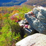 Tennessee. If you are hiking Virgin Falls, you should see this overlook before you hit the trail; it will give great respect for the terrain where you will be hiking. The hardwoods in this gulf are considered to be among the most bio-diverse left on the planet thus in the fall, virtually every color that nature can produce is visible in Scott’s Gulf. To get to Welch Point, pass the Virgin Falls parking lot and take the fork to the right. Travel about 2 miles. Park and walk less than 1000′ down hill. Click <here> for driving directions.
Virgin Falls Trail
Virgin Falls now has two trailheads. It can be accessed from the Plateau via the original trail head, or from Lost Creek. Or, it can be used as a thru-trail with a total of 10.3 miles and a total of five waterfalls in route.
Virgin Falls Plateau Trailhead
Length: 4.8 miles . Difficulty: Strenuous
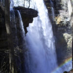

The trail length is 4.8 miles each way. If you add the spurs, you will hike closer to 11 miles total. There is a 1300′ elevation change with the majority of the change in the first third of the trail. Keep in mind that you will be climbing back up that elevation as you return so pace yourself accordingly. There are lots of rocks and roots; sturdy, fully-enclosed shoes are recommended. Wilderness camping is available, but the closest campground is 1.5 miles in.

Before you begin, if you pass the Virgin Falls parking lot and take the fork to the right, travel about 2 miles, and walk 400′ down the hill, you will be at Welch’s Point. You will take in one of the most spectacular overlooks in the state, and get an idea of the terrain that you will be hiking in.
There are three waterfalls along the route and any one of them makes the trip worthwhile. The first is Big Laurel Falls. The second is Sheep Cave, and the crown jewel is Virgin Falls.
For directions, click <here> .
Lost Creek Trailhead for Virgin Falls.
Length 4.5 miles. Difficulty: Strenuous
Park in the Lost Creek Parking area and walk south on White’s Cave Rd. 800′. The Rylander Cascade Trail provides access through to Virgin Falls. This entry to Virgin Falls is equally rigorous. The upside is you don’t have to wade through the Big Laurel Creek which can be a problem during high water.
For a map of the thru-trail to Virgin Falls click here virgin-falls-trail-pdf.
Overnighting?
Currently, Virgin Falls Camping is reserved thru Fall Creek Falls State Park. Click this link: <Camping Permit> choose the Calendar View – Campsite List tab, scroll WAY down and choose from the Virgin Falls Camp Areas or Caney Fork Camp Areas to select a location to pitch a tent. Yep, it costs a few bucks – – but it’s worth it!
Lost Creek Falls and Cave / Rylander Cascade Trail
Length: Less than 1.5 miles for both. Difficulty: Lite Hike Access: <map>
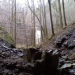
The trail to the base of Lost Creek Falls and Cave is an 800′ descent into a giant sink.
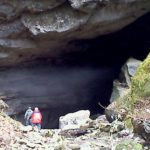
Americorp improved the trail two years ago. There are rocks and roots, but it is a good trail. The Rylander Cascade Trail is an old logging road converted to trail. There is probably not 200′ of elevation change along the trail and should be navigable to all ages.
To use the Rylander Cascade Trail, park in the Lost Creek parking area and walk south on White’s Cave Road about 800′, Rylander Cascade Trail exits to the left. The half-mile trail lies in an old roadbed and fairly level. Watch for more than one cascade as you walk up the trail. Many wildflowers are present during the spring.
For directions, click <here> .
Dog Cove
Length: 8 miles and growing. Difficulty: Moderate
Dog Cove is earmarked for equestrian use, but hikers and mountain bikers can enjoy it too. This tract of land is over 3.5 miles long and along it’s eastern 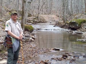 boundary joins the Bridgestone Nature Reserve at Chestnut Mountain. Formerly a working farm the fields along the lower trail contain the greatest diversity of butterflies that I have ever seen – – and of course a variety of wildflowers that attract those butterflies. The stream that flows through the cove is Lost Creek. As you follow the creek bed, you will discover how the creek earned its name; the water disappears and reappears several times along the way before eventually traveling under the mountain and pouring out of a cave and over Virgin Falls. Along the upper trail is a small natural arch, and lots of beautiful hardwoods. The upper trail is where the trail earns the moderate-hike rating. Lost Creek Road going east, dead-ends into Dog Cove. Click <here> for driving directions.
<more coming soon>
Rock Island State Park Trails
Fall Creek Falls State Park Trails
Carter Street Park / Calfkiller River Trail
Bridgestone Centennial Wilderness Area Trails
Polly’s Branch Trail
Yellow Bluff Trail
Chestnut Mountain Ranch Trail
Yellow Bluff Trail
Caney Fork River Trail
Bee Creek Trail
Shop Gap Trail
Davis Cemetery Trail
Flowing Well Trail