If you paddle-up an appetite, be sure to check our Shop/Dine section for great food and beverages.
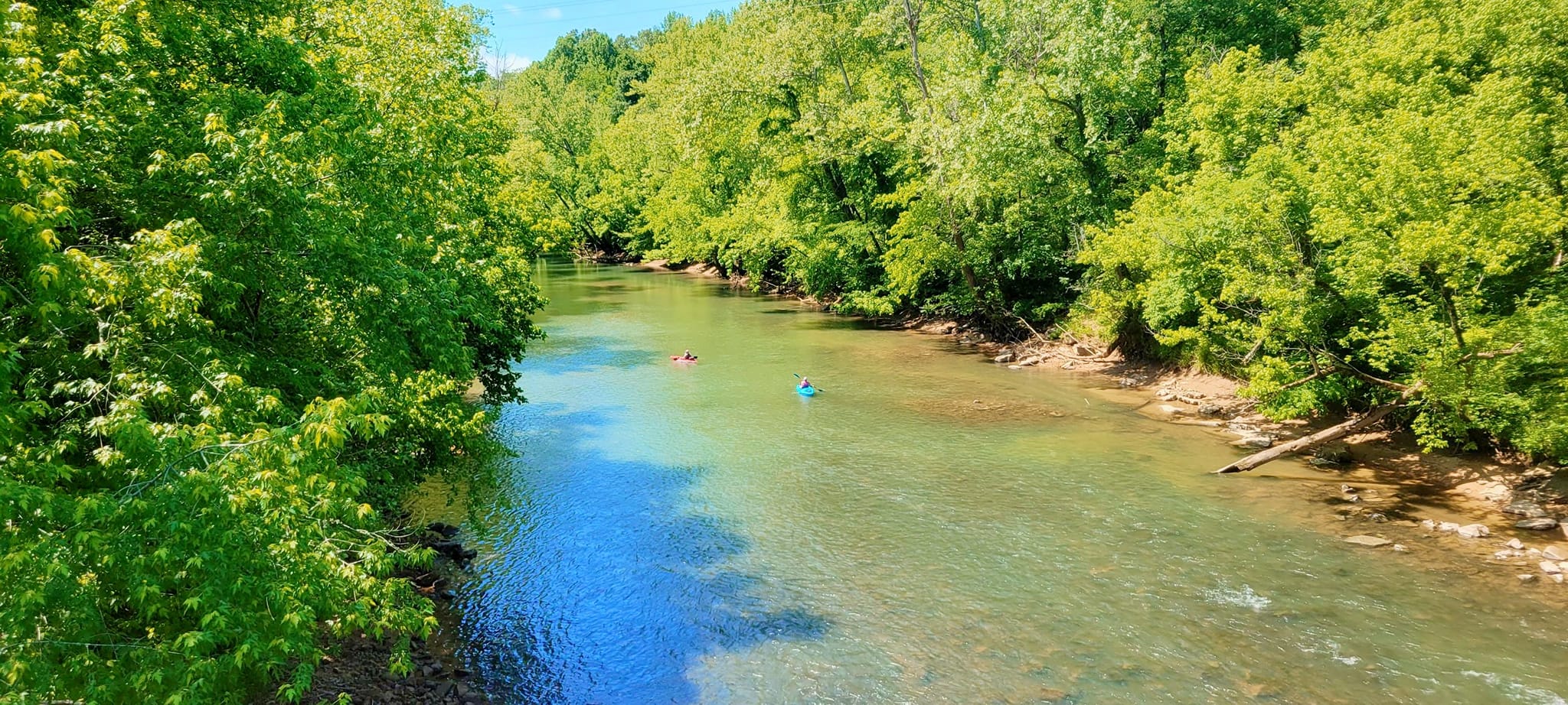
Upper Calfkiller: Multiple access points are available along State Hwy. 84 running from Monterey to Sparta Tennessee. During winter’s high-water, you can put in as far up as Mill Creek in Putnam County. Year-round access is  viable starting at the White County line on 84 and heading South, though some portaging will be necessary during dry seasons. Expect easy paddling and mainly gentle currents along the way. The cool cave-fed river takes you through remote forests and pastoral farmland. Abundant wildlife will almost always be seen. There are several locations where small waterfalls and springs pour over bluffs into the river. This is a truly scenic float, but be prepared; you may not see another human being for hours at a time.
Middle Calfkiller: FUN, FUN, FUN, flatwater. The best access point is from the wildlife ramp on the South end of Church Street (pictured) in downtown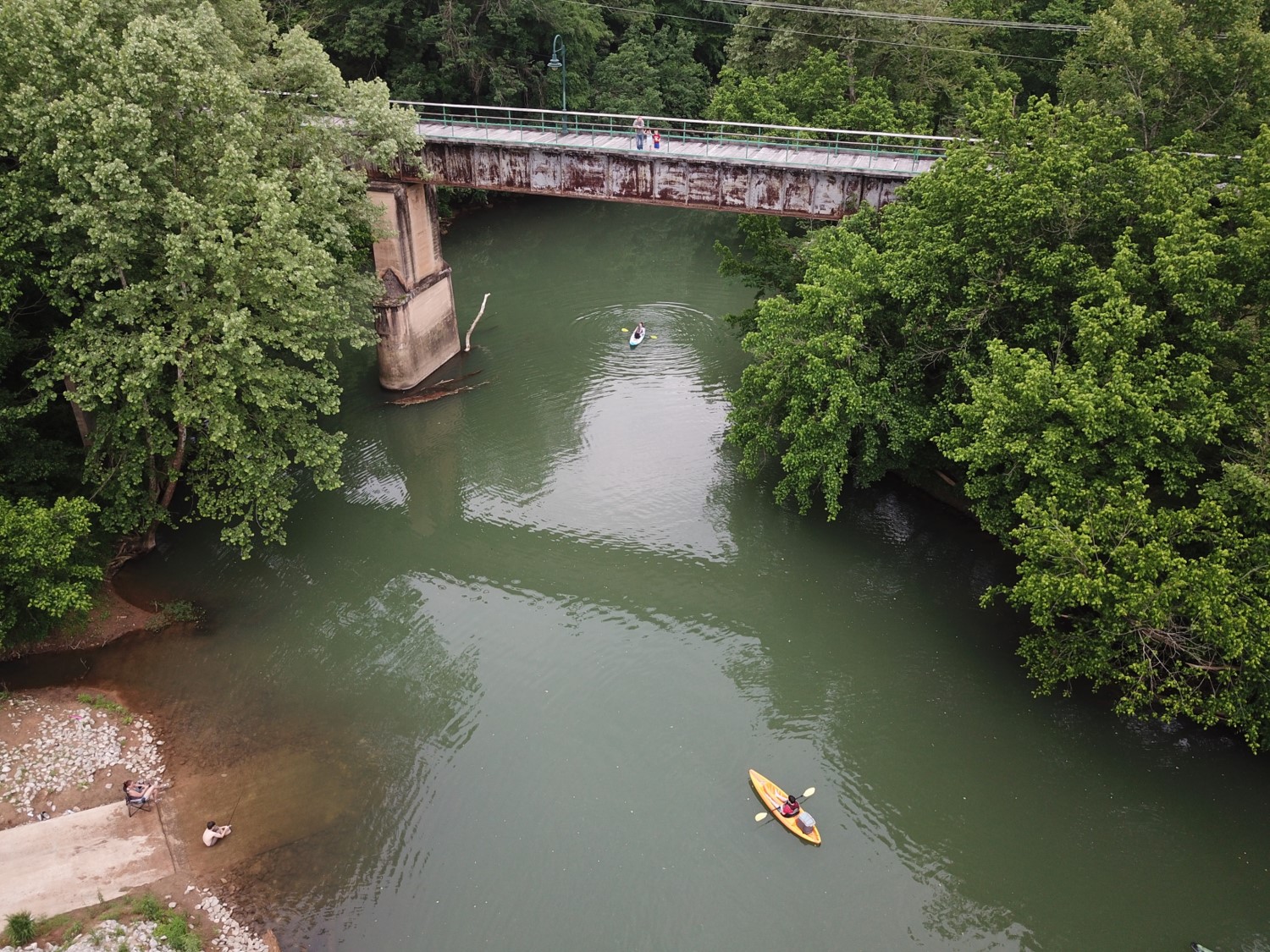 Sparta. You can paddle upstream under Bockman Way all the way to City Lake Dam. You can paddle downstream to the power house dam at Hwy. 111. Be aware that both of these are low-head dams and when they are in sight, you are close enough; low-head dams can be dangerous. The launch ramp has a picnic shelter, or you can pull out at the Bockman Way (Hwy. 70) bridge and walk to several restaurants, galleries, etc. in the historic downtown section of Sparta. For driving directions to the boat launch click <here>.
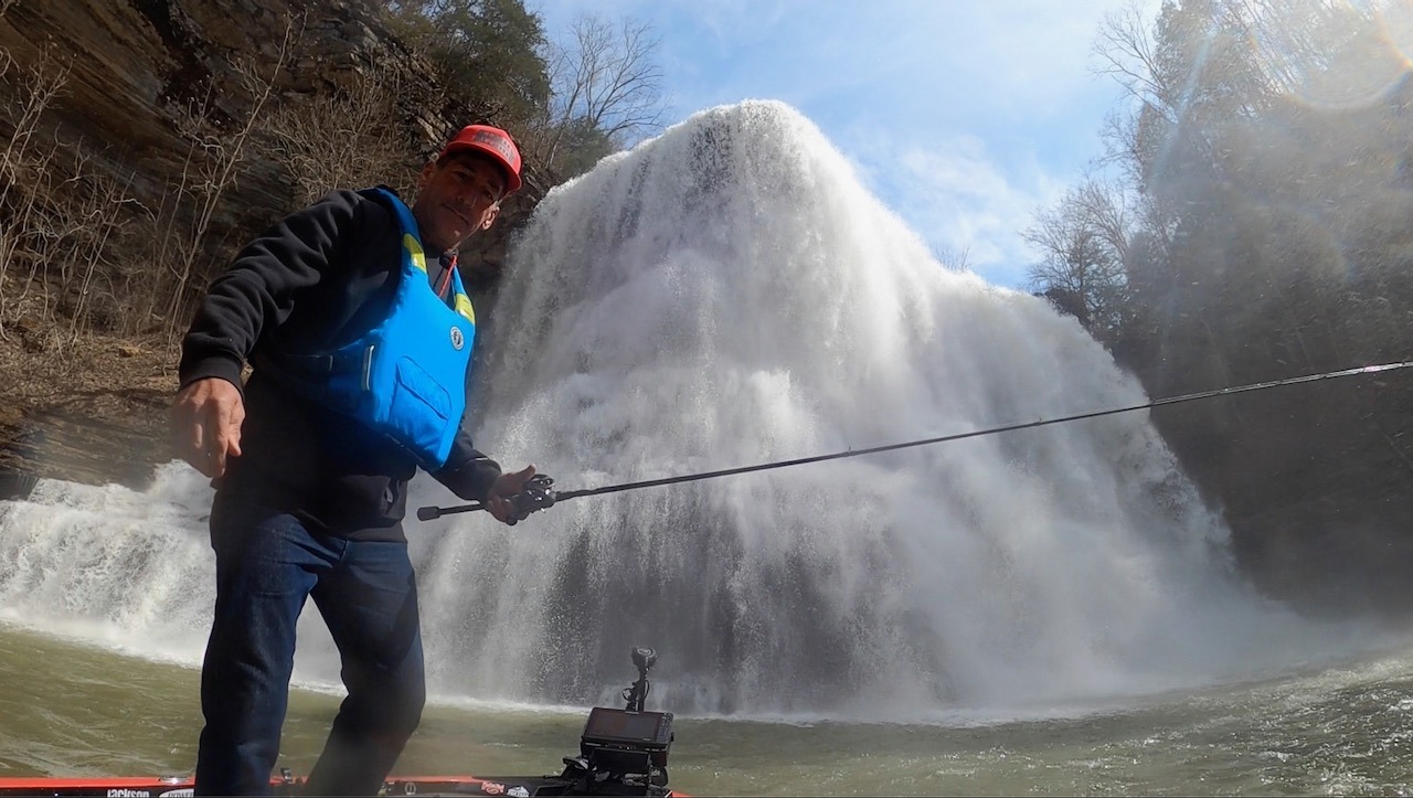
Lower Calfkiller: The Lower Calfkiller runs from the Hwy 111 bridge to Rock Island Lake. Near highway 111, there are some exciting spots, but the river soon runs into the backwater of Rock Island Dam. I think that this video of Eric Jackson fishing that portion of the river is the best description that we can give. Enjoy. <Eric Jackson fishing the Calfkiller>
Caney Fork River: Mitchell Ford to Plum Lee Ford. The most recent addition to our paddling paradise has barely moving water followed by a 400′ portage and then into more barely moving water or the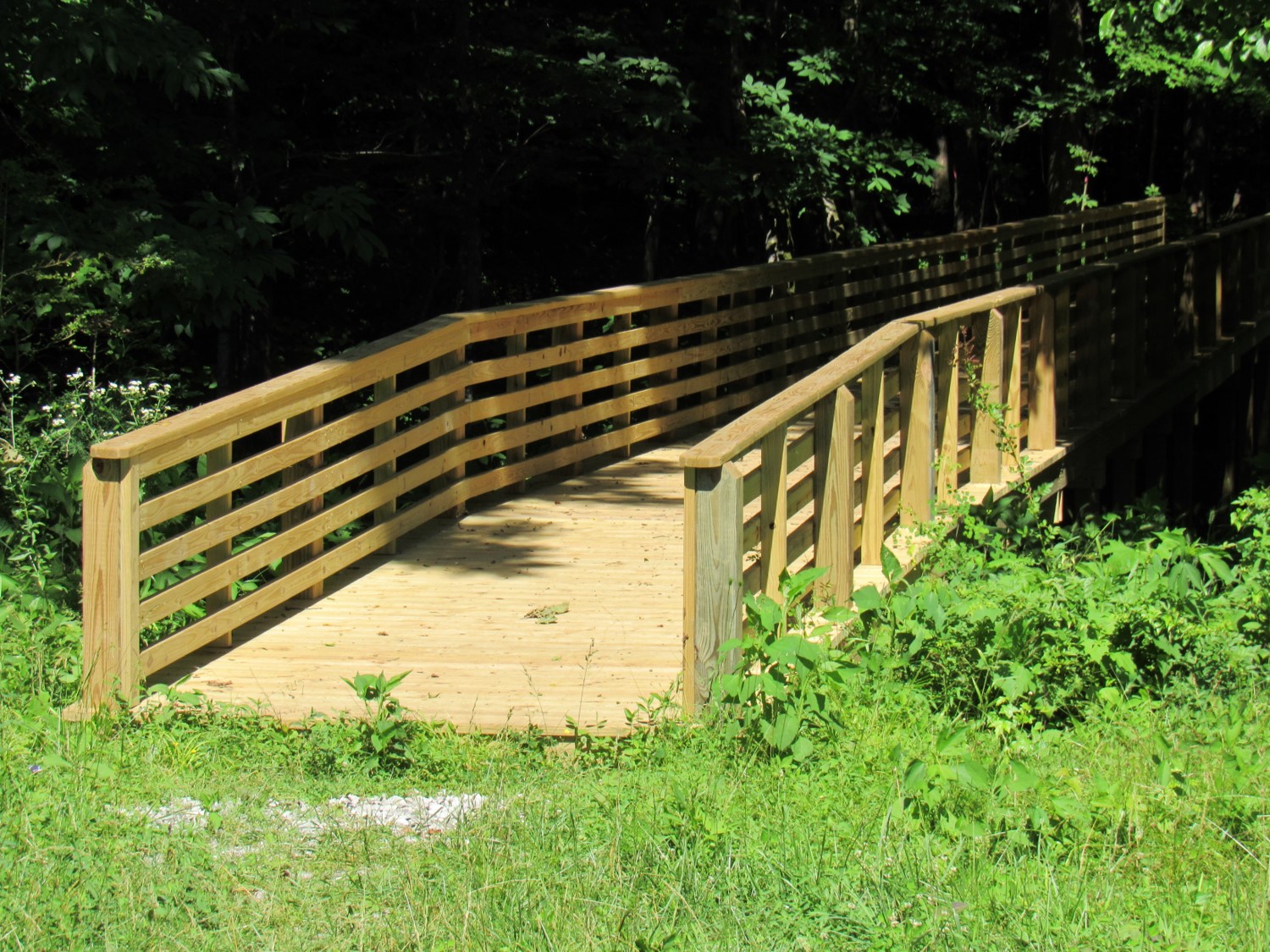 backwater of Rock Island Dam, depending on the time of year. This is a comfortable five-hour trip of lazy paddling through some peaceful countryside. You will see limestone cliffs along the first part of the paddle, abandoned highway and bridge ruins along the middle, and beautiful homes surrounded by river shanty’s toward the end. This is an easy float in a canoe, kayak or john boat. The beginning point is a parking lot just east of Frasier Bridge. There is a Mennonite-built foot bridge to get your boat across a deep gully and to the water’s edge. This is not the easiest launch, but worth the trip. Enjoy. For driving directions to the Mitchell Ford kayak access (put in), click <here> . For driving directions to Plum Lee Ford (take out) click <here>.
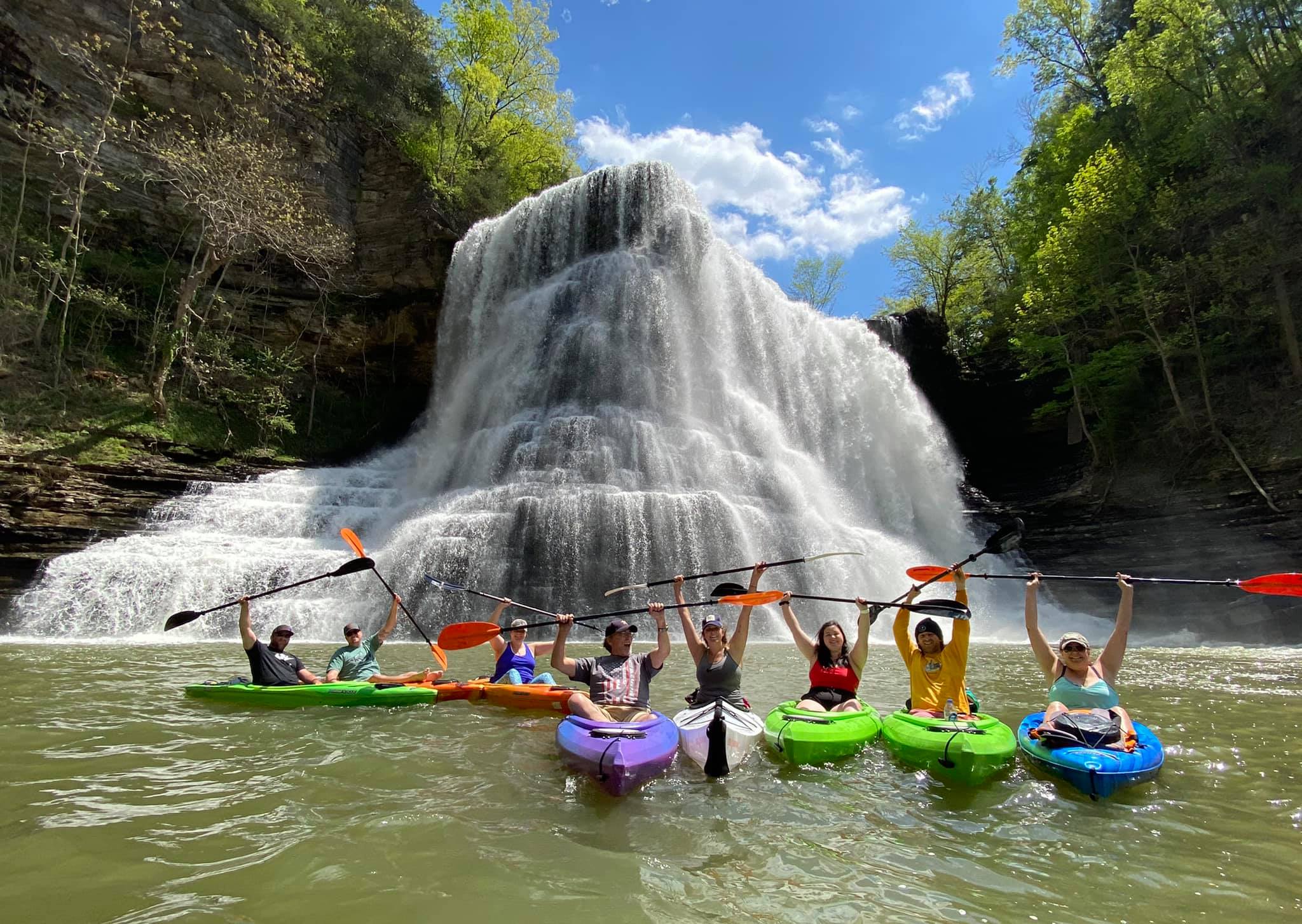
Burgess Falls via Cane Hollow Paddle: Center Hill Lake has beautiful flatwater and good fishing. The Corp of Engineers has raised the lake back to full pool meaning that you can now paddle a kayak up to the base of one of the most spectacular waterfalls in the state. Many have lamented that Burgess Falls State Park never replaced the stairs to the base of the falls after the 2004 floods. Most photographers agree that the best view of the falls is from below; you will see why when you get there. The paddle is barely over 2 miles each way and is a great way to spend a few hours. You will probably want to paddle ashore and picnic and grab some great photographs. It is not unusual to see people swimming in the plunge pool where Falling Water River pours into Center Hill. Be aware that while there is no current, a southwest wind can lead to additional paddling as you return. Also note that Cane Hollow is approved by the Corp for camping. Many paddlers will spend a night so that they can visit Cummins Falls the next day. Easy trip, beautiful scenery, flat water. To watch a video of the paddle click Youtube video of paddle to Burgess Falls. For driving directions to the Cane Hollow launch point click <here> .
Fancher Falls via Cane Hollow. A century ago, Fancher Falls had a great water-wheel that powered a mill. The mill was located a short distance from a major north-south route called Old Kentucky Road. Fancher Falls is private property and not approachable from the top, however the base of the falls ends in Center Hill Lake which is navigable water. The trip is barely over 4 miles each way so plan a day. Be prepared to share your water with powerboats as you make the paddle, Center Hill Lake is a popular boating and fishing destination. About 3 miles into the trip, you can look a half-mile southwest and see Cookeville Boat Dock. The lake grows much narrower as you approach your destination, but there is no current. Fascinating geology in a narrow gorge would make the visit worthwhile even if there were no waterfalls. For driving directions to Cane Hollow launch point click <here> .
Outfitters
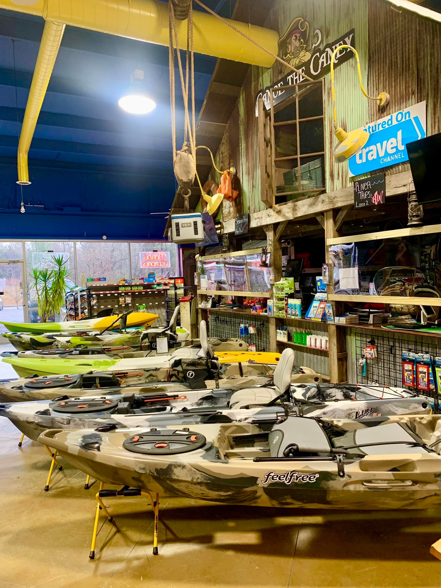
Canoe The Caney is the largest outfitter on the Caney Fork River. In addition to rentals, Canoe The Caney has an excellent storefront where you can purchase paddling gear. 17055 Smithville Hwy. Silver Point Tennessee. (800) 579-7893

Cumberland Kayak known as Nashville’s Skyline Paddling Company can arrange a trip on the Cumberland River in Nashville, or to the base of Burgess Falls in Sparta TN. Great fun for the whole family. 1 Victory Avenue, Nashville, TN. (615) 800-7321
Kayaking Adventures of Tennessee. The first outfitter to specialize in taking tours to the base of Burgess Falls. Book your reservations via their Facebook page by clicking this link: <Book-a-Float>
Sunseeker Outfitters. Specializing in the Calfkiller River, waterfall tours and custom floats anywhere in the area. Kayaking lessons available, Level II ACA Kayak Instructor. Click the link for more information. <SunSeeker Adventures>

Caney Fork River, Scott’s Gulf Section:
Running from the end of Scott’s Gulf  Road to Big Bottom. During the majority of the winter months this stretch is Class II and III whitewater. Sixty percent of this county drains through cave systems, during the summer, the Caney Fork disappears and reappears several times along this stretch; in the summer, this stretch can be a 7-mile long portage over river rocks that are as slick as silicone. Even during the summer, there are three beautiful natural pools known as The Fork Hole, Amber’s Den, and The Ford Pool that are worthwhile flatwater paddles. Only experienced paddlers with whitewater equipment and experience should attempt navigating between the pools. While advocates maintain the run is spectacular and worth it I have seen the remains of many a shattered kayak and canoe along this section. In some spots, rescue would be near impossible. Again, let the paddler beware.
Caney Fork River Headwaters: Class V Whitewater. While this is a favorite run for the most experienced kayakers and attracts paddlers from all over the 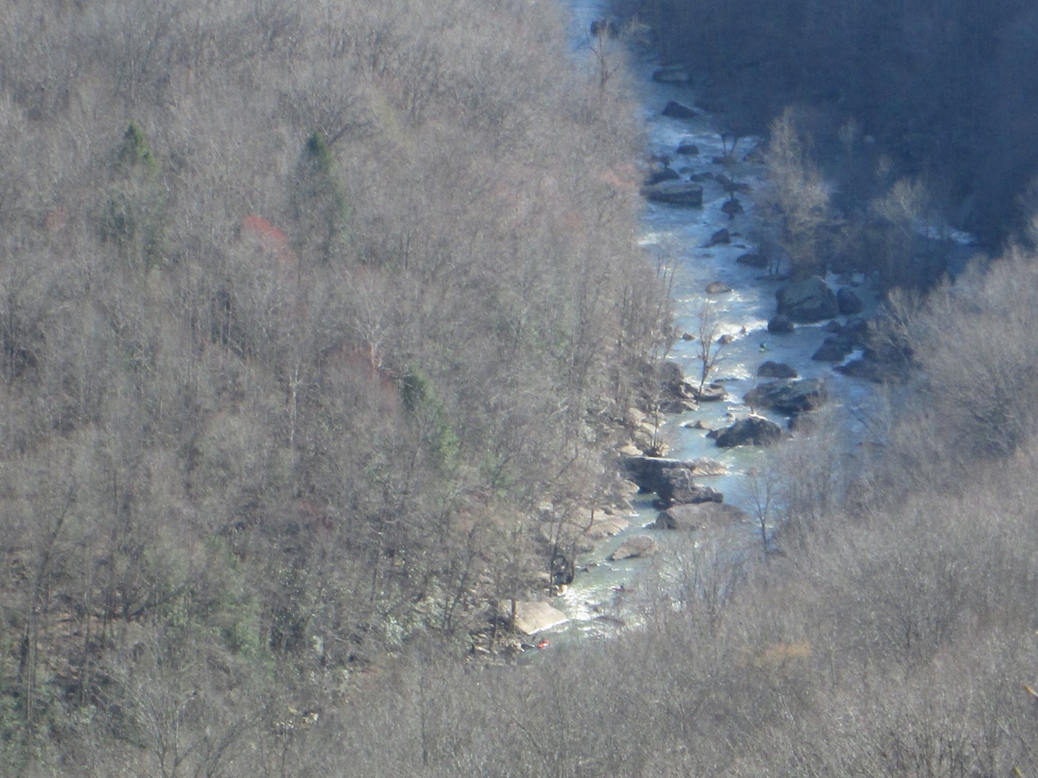 world; one kayaker summed it up “you can do it once, you can do it twice, but if you do it consistently, you will be killed.” You loose about 500′ in elevation over 5 linear miles along this stretch, as the Caney Fork drops off of the Cumberland Plateau. The picture is taken from Yellow Bluff in the Bridgestone Centennial Wilderness Area, if you look closely you will see a red kayak that has descended over 400 feet by the time he got to this point. Weary paddlers generally pull out at the intersection of the Caney Fork and Bee Creek at the end of Scott’s Gulf Road. Let the paddler beware. . . .